
The Great Polish Map of Scotland
Hidden in the beautiful Scottish Borders lies one of the most extraordinary monuments in Europe – a giant three-dimensional map of Scotland, created by Polish soldiers and friends of Scotland.
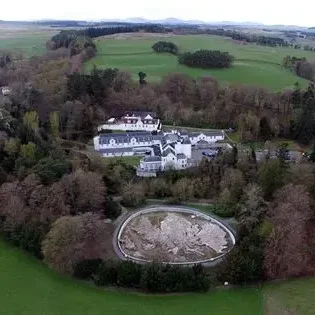
Built in the grounds of Barony Castle Hotel, the map celebrates the historic friendship between Scotland and Poland and tells a story of gratitude, creativity and shared heritage.
Today the map continues to inspire visitors from around the world and reminds us how powerful international friendships can be.
What is the Map
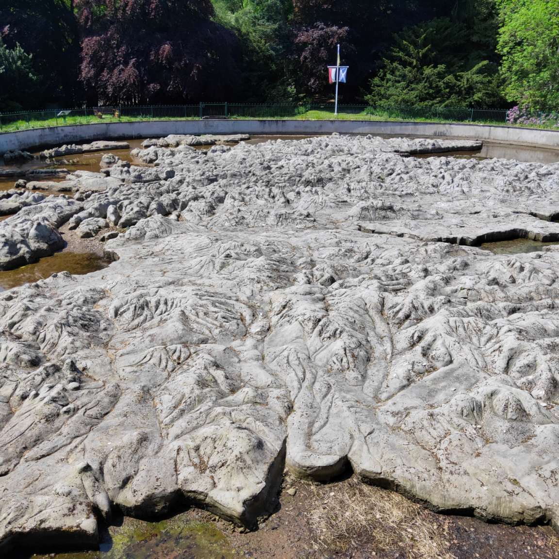
The Great Polish Map of Scotland is the largest three-dimensional terrain model of Scotland ever built. Measuring around 50 by 40 meters, it recreates the mountains, islands and coastlines of Scotland in concrete relief.
Originally built between 1974 and 1979, the map was designed by Polish geographers and constructed with the help of hotel staff, volunteers and students.
It is not only a remarkable work of landscape art - it is also a powerful symbol of friendship between two nations.
Heritage
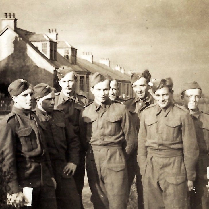
The map was created as a tribute from Polish soldiers and veterans who found safety, friendship and a new home in Scotland during and after the Second World War.
It stands today as a lasting reminder of the deep historical connections between Scotland and Poland — connections built through shared struggle, cooperation and cultural exchange.
Supporting The Community
Caring for the Great Polish Map of Scotland is not only about preserving an important piece of heritage — it is also about supporting the future of the local community. Located near Peebles, the map has become a unique cultural attraction that brings visitors to the Scottish Borders from across the UK and beyond.
As interest in the map grows, it helps promote tourism and supports local businesses including cafés, accommodation providers and shops. Events, educational visits and community initiatives linked to the map also create opportunities for collaboration and engagement. By preserving the Great Polish Map of Scotland, the community is investing in a landmark that strengthens the region’s identity while contributing to the local economy and long-term development of the area.
Scottish Borders
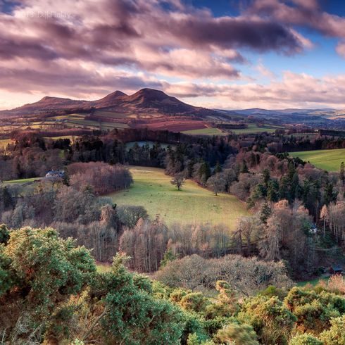
A visit to the Great Polish Map of Scotland is the perfect starting point for exploring the beautiful region of the Scottish Borders.
Located near the charming town of Peebles, the map offers visitors a unique and memorable introduction to the area’s landscape, history and cultural connections. Peebles itself is known for its welcoming atmosphere, independent shops, cafés and riverside walks along the River Tweed, while the wider Borders region is famous for its rolling hills, historic abbeys, scenic cycling routes and outdoor adventures.
Starting your journey at the Great Polish Map of Scotland allows visitors to see the entire country in miniature before setting out to discover the real landscapes beyond. From here, travellers can continue exploring the rich heritage, natural beauty and warm hospitality that make the Scottish Borders one of Scotland’s most rewarding places to visit.
Visiting Peebles and The Great Polish Map of Scotland
The Great Polish Map of Scotland is located in the peaceful countryside of the Scottish Borders, within the grounds of Barony Castle Hotel, just a short distance from the historic town of Peebles. The location is easily accessible from several major cities across Scotland and makes for an enjoyable day trip.
From Edinburgh, the map can be reached in around 45 minutes by car. The most direct route is via the A703 through the scenic countryside of Midlothian and the Borders. Visitors travelling from Glasgow can expect a journey of approximately 1 hour and 30 minutes, typically following the M8 and then continuing south towards Peebles through the picturesque Tweed Valley.
For those travelling from Stirling or central Scotland, the journey usually takes around 1 hour and 30 minutes by road, passing through beautiful rural landscapes before reaching the Borders. Visitors coming from Newcastle upon Tyne can reach the site in about two hours via the A68.
Once in Peebles, follow signs towards Eddleston and Barony Castle Hotel, where the map is located within the hotel grounds and accessible to visitors. Parking is available on site, and the surrounding area offers excellent opportunities for walking and exploring the Scottish Borders.